- Author Isaiah Gimson gimson@periodicalfinance.com.
- Public 2023-12-17 02:53.
- Last modified 2025-01-24 12:06.
The image of large objects can be obtained on paper or any other medium only in a reduced form. This primarily applies to various maps of the area. The scale of a map is the ratio of the length of a line drawn between two points on a plan or map to the same distance on the ground. Knowing the scale is necessary in order to measure distances on the map.

Instructions
Step 1
Usually, the scale of any map or diagram is indicated in its legend - the accompanying explanatory text. The scale can be depicted as a scale or text, which indicates how many meters or kilometers on the ground is equal to 1 cm of the distance plotted on this map. A scale of 1: 50,000 means that 1 cm plotted on this map is equal to 500 meters or 0.5 km in nature. The larger the scale, the lower the number shown in its numerator. Topographic maps of scale 1: 10000 and larger are classified as classified information.
Step 2
We can speak about a fixed scale only when there is a paper-based map print. In the event that the map is given in electronic form, its scale depends on the magnification factor of the image.
Step 3
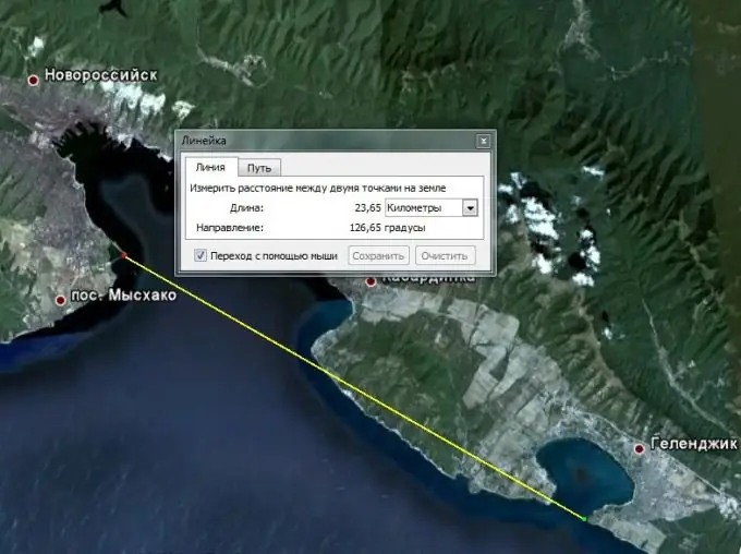
If for some reason the scale of the map is not specified, there is no out-of-frame design or legend, then it can be determined using the geoinformation map servers GoogleEarth or YandexMap, turning them on in the "Hybrid" mode, which allows simultaneously with the satellite photographic base to see a digitized image of the terrain - roads, city boundaries, detached buildings.
Step 4
Determine on the map the geographical position of the terrain depicted on it. Select two characteristic points on it that can be easily identified from the satellite image of the area. Usually, it is convenient to use for this crossroads of highways or improved highways, highways.
Step 5
Find these two points from the satellite image of the area. Use the Ruler tool to measure the distance between them. When you activate the tool, a plate appears, where the distance between the two points you specified on the space satellite image will be automatically highlighted. Set the units of measurement convenient for you - meters, kilometers.
Step 6
Divide the distance obtained from satellite images by the number of centimeters measured on the map. You will get the scale value for this map.


